Explore the wreck sites in 3D
On this website you can explore several wreck sites from the Isles of Scilly using a 3D site plan. Underneath each model is an explanation of how to begin the tour, or how to navigate the model yourself. Scroll down to find out about the design philosophy used to create these site plans.
The following 3D site plans are available:
- Association
Wrecked in 1707, cannon in deep boulder-lined gulleys - Bartholomew Ledges
16th century wreck spread across a rocky ledge - Tearing Ledge
The wreck of the Eagle, sank 1707, with cannon and anchors - The Wheel Wreck: Site Plan | 3D model of cargo mound
Large cargo mound of 19th century pumping equipment - HMS Colossus (opens in new window)
74 gun warship built in 1787 at Gravesend and wrecked in 1798
Instructions
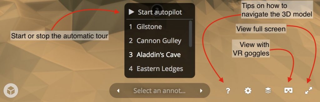
When the site plan has loaded, hover your mouse or tap the Sketchfab viewer to see more options. From here you can start “autopilot” to begin or resume the tour. You can also tap the “?” icon to see tips on how to navigate the model. Use the right-hand opposing arrow icon to launch full-screen. The following image shows some of these controls.
Our approach to the wreck sites
All of the sites around the Isles of Scilly that are covered on this website are very different in terms of character. Because of the rocks, tides, currents, and the passage of time, there are no timber remains of any of the ships except on the Colossus. Many of the sites have had items removed, or have in the past been disturbed in some way. Each of the wreck sites has its own difficulties to dive in real life – from dense kelp and seaweed growth, to the scant remains being hidden underneath house-sized boulders that have been rolled around in heavy storms.
In order to give the non-diving viewer a sense of each site, we have decided to opt for a unified visual approach. For each wreck, we collected our own 3D data of the shape of the seabed through the use of multibeam sonar collected from a survey vessel. This data, although very accurate, had to be reduced in order to allow us to present it online, with the high density data being retained by Historic England to aid their management of the sites and inform future research.
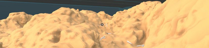
Our simplified 3D models of each site allow us to convey just how rugged the terrain is. We chose to ‘encase’ each site in a transparent box to reinforce the representation of a submarine environment, using real depths to show the height of mean low water (low tide) above the site. Simple 3D representations of the types of objects on the site have been included to show the distribution of finds and features that survive today. We created 3D models of every type of cannon, gun and anchor present.
We chose not to provide realistic colours, waving seaweed, or marine creatures, opting instead for a clean “Minecraft” style view. A clear representation of the site was our priority – an accurate site plan based on real archaeological and geophysical data. The real experience of a dive, which is evident in the videos for each wreck, is one of hunting – and not always with success – for the cannon and anchors under rocks, amongst seaweed, or hidden in plain view. Many are covered in a concreted layer of rust, barnacles, and more: almost elongated rocks in their own right. Recreating this, we felt, would not provide a helpful understanding of the site to a non-specialist audience.
Our annotations on the 3D models – the small numbers that can be clicked on each site – allow the viewer to read further information, and see photos and videos of the real site. CISMAS divers captured high quality HD footage on their cameras on each wreck, so the images can help the viewer to experience the site as the diver does.
Combining the simplified 3D site plans with the “diver’s eye” video and the photographic and documentary evidence on this website should, we hope, help you to understand each of the wreck sites – and serve as a starting point for your own research.