Menu: Site Background | 3D Site Plan | Dive Video | Site Detail | Final Voyage
Click the play button to begin the tour. Click anywhere on the model to stop the fly-around and explore the model. See instructions below.
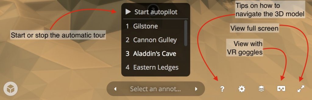
Instructions
This interactive site plan is based upon a model of the seabed collected using multibeam sonar survey undertaken for this project. You will see representations of the larger items located on the seabed relating to the wreck. Many of these items are marked with a number which can be clicked. You can then follow a link to read more detailed information. Clicking “Find out more” will open a new window with further information. Just close that window or browser tab to return to the model.
At any point you can click on the site plan to stop the tour and explore the site. Use your left mouse button, or one finger to rotate the model. Use your right mouse button or two fingers to pan around.
Use the menu on the bottom of the 3D site plan to explore further options. The model is hosted by Sketchfab.
Find out about our approach and philosophy for these 3D site plans.